MINCO HISTORICAL SOCIETY


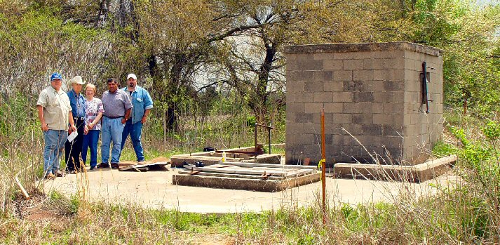
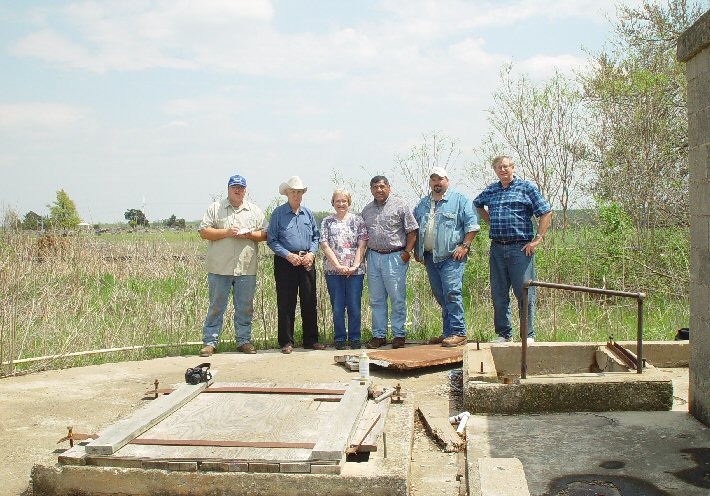
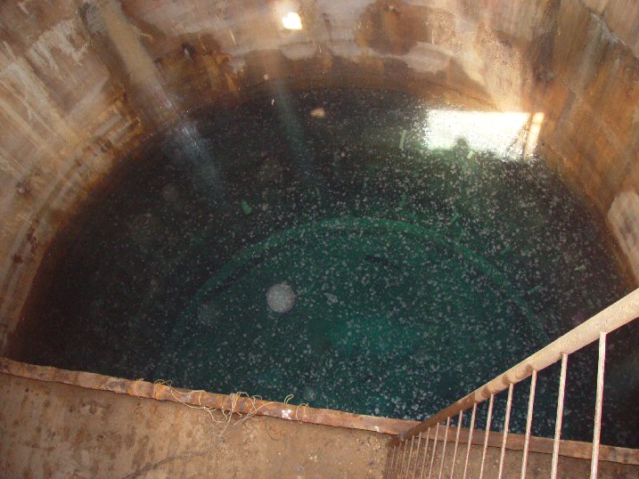
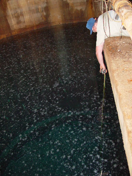
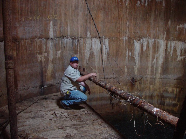
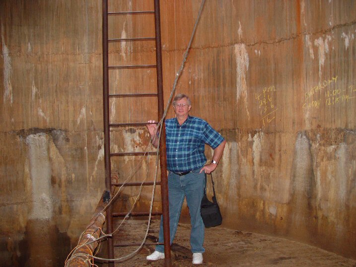
Minco's Railroad Well

      Minco has the potential of establishing a State Historical Site for its railroad well north of Minco, as it is the only known railroad well remaining in the state of Oklahoma.  Railroad wells were used to keep the railroad water towers full for steam engines that needed a water refill.  The water tower served by Minco's railroad well was located a half block north of Main Street, just north of the old Rock Island train depot. 
      Virginia Hayes is actively pursuing the necessary administrative actions for establishing the well as a historical site.
      The railroad well north of Minco is actually the second railroad well.  The first one was in a stream stream bed just north of Minco's water plant and northeast water tower, and was known to be there when the map was made in 1914.  It surely flooded when it rained heavily, and ruined the water for steam purposes, necessitating relocation of the well to higher ground further north to its present location.  The date of the newer well is unknown, but  the dimensions of the new well are identical to the old well.
      On Saturday, April 10, 2004, city employees opened the well for examination by historical society members.  See pictures below:

The railroad well.  The city once used it when the railroad ceased needing the water, but discontinued due to excessive levels of chemicals from farming. overallview3x10.jpg (162480 bytes)
L to R:  Shaun Bliss, city waterworks employee; William "Bill" Johnson of El Reno, early Minco resident familiar with well; Virginia Hayes, society secretary; Richard Subia, society member and State Representative; Tim Anderson, city water superintendent; Marvin Woodworth, society president rrwellgroup7x10.jpg (169350 bytes)
View from entry hole.  The bottom of the well is so clearly visible and the water so transparent that the well at first appears empty.   The water's surface is best determined by noting the floating flecks. 

NOTE:  All pictures can be enlarged by clicking on them.

rrwell-viewdown8x10.JPG (147143 bytes)
From the ceiling to the concrete platform is 25 feet.

(This is 3 pictures spliced together)

rr-well-ladder-4x10.jpg (53713 bytes)

And from the platform to the bottom is about 29 feet.  Shaun's 25 foot measuring tape could not reach the bottom.

measuring8x10.JPG (169523 bytes)

Looking west. Light in this picture is natural light from the entry hole. natural-light-8x10.JPG (152278 bytes)
Marvin "Woody" Woodworth woodybyladder8x10.JPG (145177 bytes)
Richard Subia and Virginia Hayes viewing well.

Richard-and-Virginia-looking-down8x10.JPG (123501 bytes)

  As a byproduct of Virginia's contacts, the Union Pacific Railroad sent her two maps of Minco's railroad which show locations of former spurs, cattle lots, mills, cotton gins, wells, etc.  These maps have proven invaluable, as they have served to identify businesses and old pictures of businesses along the railroad through Minco's early years.  For example, we have a picture of the Brett or Minco Mill and Elevator Company, but previously had no precise location, and nothing to indicate a spur went between its two large structures.  The exact location of the mill below is now located by the railroad map (see below).


NOTE:  North is -->
In other words, the mill and spur was once located where the Minco water plant is now.

There is also an old picture of a train behind the old cotton gin (above, now gone), which appeared to be an impossible feat or the picture was of another cotton gin, but this map explains that the spur was there also.